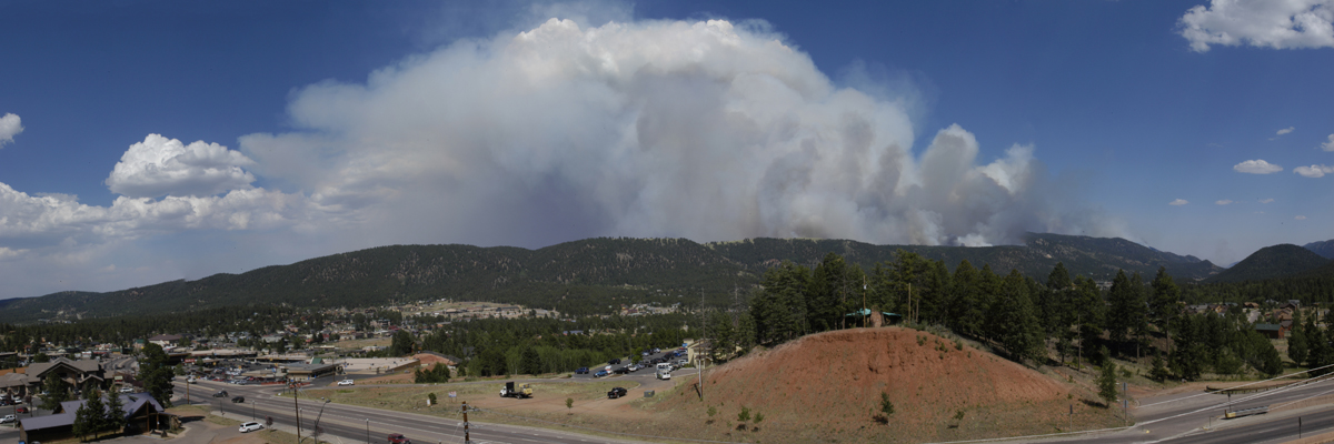
On June 23, 2012, the Waldo Canyon Fire ignited west of Colorado Springs. After taking 2 lives, burning 346 homes, forcing the evacuation of 32,000 people, and consuming over 18,000 acres of private and public land, the fire was contained on July 18th. The fire directly affects five major watersheds – Headwaters of Fountain Creek; Cascade Creek-Fountain Creek; Camp Creek/Garden of the Gods; West Monument Creek and Lower Monument Creek. The Waldo Canyon Fire was one of the most destructive fires in Colorado history and will continue to impact communities for many years to come.
Post-Fire Impacts
After the devastation of the fire, communities around the burn scar are now grappling with post-fire flooding, water quality degradation, and ecological impacts. Erosion, debris flows, and fast-moving stormwater are major concerns for public safety, property damage, and environmental impacts. These concerns are magnified by the terrain, geology, and close proximity of communities to the burn scar. Steep hillslopes, multiple canyons, and highly erosive soils contribute to water and debris flows that threaten downstream communities and damage the landscape. Communities in and below the burn scar have experienced significant flooding and damage to vital transportation and water infrastructure. The threat of flooding around the burn scar will continue to be elevated for years to come.
CUSP’s Involvement
Shortly after the fire was contained, CUSP was enlisted for recovery assistance by staff from the U.S. Forest Service, Colorado Springs Utilities, El Paso County, the City of Colorado Springs, the City of Manitou Springs, and private landowners. Although the Waldo Canyon Fire did not burn in the Upper South Platte Watershed, we felt compelled to assist our neighbors with rehab efforts in connecting watersheds, and to protect a key transportation corridor in and out of our watershed on the southeast side (Highway 24). Recognizing the imminent threat of more flooding and sediment flows, CUSP is working with residents, businesses, and government agencies to protect communities in and below the burn scar. Through collaborative planning with our partners, we are implementing projects that stabilize hillslopes and slow erosion to protect lives, homes, and watersheds. Please see the Waldo Canyon Watershed Assessment of River Stability and Sediment Supply (WARSSS) Report for more detailed information on impacts and project prioritization.
How You Can Help
The Waldo Canyon burn scar will take decades to fully recover. Your continued involvement is critical for supporting healthy forest regeneration and high-quality water in the burn scar and beyond.
Funding is vital to support work that promotes healthy forest recovery, improves water quality, mitigates flooding, restores rivers, improves habitat, and protects communities. Your contribution is used to fund on-the-ground recovery work, equipment, materials, and seed and trees for revegetation. Your donation is also used as matching funds for federal, local, and foundation grants, thereby tripling your impact.