-
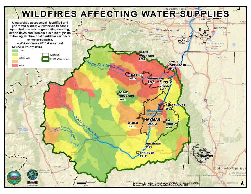 Understanding how wildfires would affect water supplies in the Upper South Platte Watershed helps us prioritize forest health projects.
-
 Mapping where noxious weeds are growing helps CUSP and our partners understand the extent of noxious weed infestations and prioritize mitigation projects.
-
 This map was created to understand some of the values at risk in the Bailey area that would be impacted by a wildfire.
-
 Knowing where slash site patrons are coming from helps us improve our slash site program and target underserved areas.
-
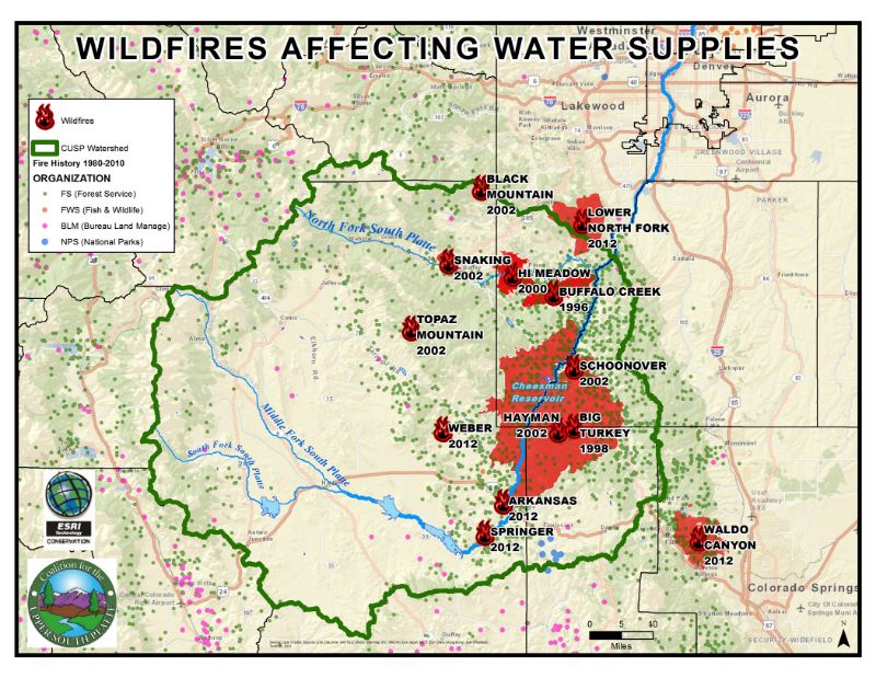 Visualizing the spatial relationships between wildfires and source water can help people make the connections between wildfire threats, post-fire impacts, and water security and quality. Maps like this one are used in our education and outreach efforts.
-
 This map was created to orient hikers of the Morrow Mountain Trail and appears at the trailhead in Bailey, CO.
-
 Using maps is a critical part of our emergency preparedness and post-fire flood mitigation work. This is an example of a map used by Manitou Springs to prepare for flooding following the Waldo Canyon Fire.
-
 CUSP maps support Community Wildfire Protection Plan decision making.
-
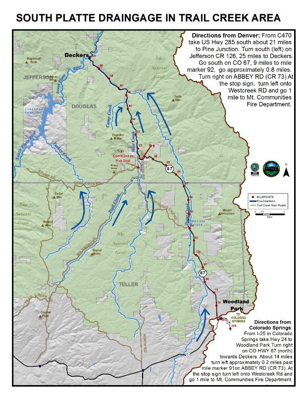 Directional maps are important for ensuring our volunteers and partners are able to find project sites.
-
 This map provides an overview of CUSP’s various programs throughout the watershed.